![]()
![]()

Digital, Distance Measuring & Counting Tools for Construction Estimating & Map Enthusiasts
Scalex Corporation is the world's leading manufacturer of digital distance measurement tools. These innovative electronic, digital, hand-held tools enable you to take scaled measurements off prints, plans, and maps in virtually any scale, Imperial & Metric.
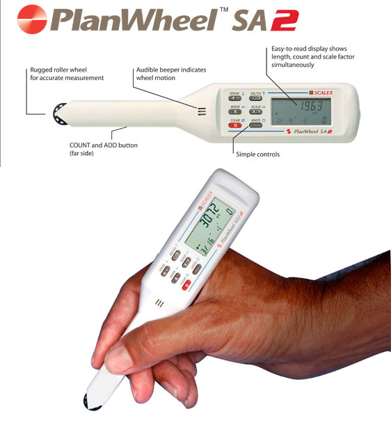
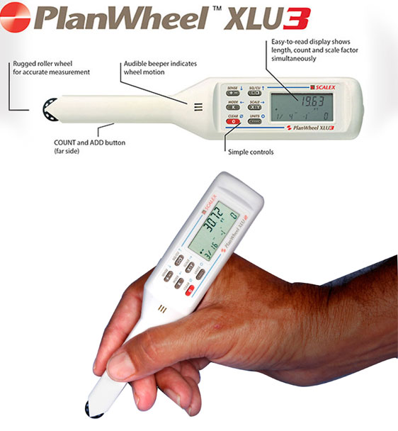
Scalex PlanWheel:
Distance Measuring and Counting Tool for Architects, Engineers, Construction Contractors and more.
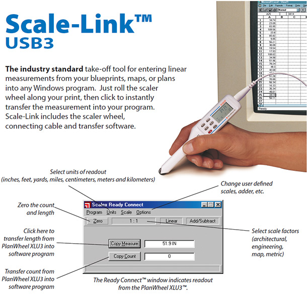
You won’t find a better quality tool for measuring blueprints, architectural drawings and landscape plans. They are perfect for construction estimating, quantity takeoff, or surveying and more. PlanWheels measure in Inches, Feet, Yards, Miles, Centimeters, Meters and Kilometers
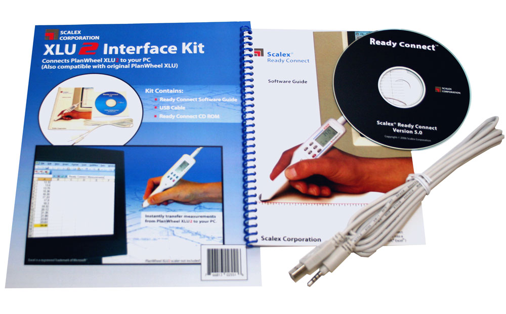
- The Scalex PlanWheel line of products includes the PlanWheel SA2, the PlanWheel XLU3, Scale-Link USB 3, and the NEW Scale-Link Wireless 3.
- Measure prints and plans in ANY scale, including Architectural Scales, Engineering Scales, and Metric Scales and create your own custom scale if you can’t find what you need in the 111 built-in scales available.
- Features a Counter button and a linear Adder button for quick adding of standardized lengths
- Architects: The Scalex PlanWheel line of products makes a perfect Architects Ruler
- Engineers: The Scalex PlanWheel line of products makes a perfect Engineering Ruler
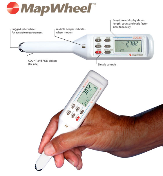
Scalex MapWheel:
Map Measuring Tool for Hikers, Bikers, Boaters, Adventure Racers, RVers and more.
This compact, handy tool for measuring road, trail, forestry, and topographical maps stows easily in your backpack or glove box and is perfect for planning and plotting out your next great adventure. MapWheels measure only in Miles, Kilometers and Nautical Miles. (MapWheels are not intended for use on blueprints or to do estimating takeoffs – please see our line of PlanWheels for those purposes.)
- Measure your route on ANY Map with the Scalex MapWheel
- Affordably priced, the MapWheel is a great gift for the traveler on your list
- Map Measurement the easy way!